|
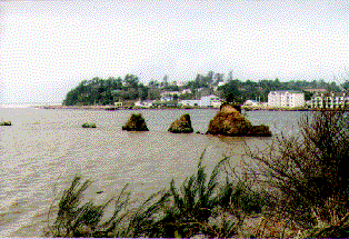
In this photo we see what remains of an eroded basalt dike. These rocks in a line are all that remain of a basalt wall like structure that flowed intrusively into the surrounding sandstone formations millions of years ago. The basalt was more resistant to erosion than the rock into which it intruded. Surrounding the headlands in the background we can see wavecut platforms just above the tideline. |
|
|
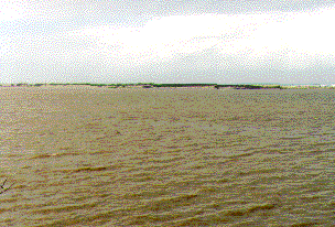
Here we can see a long sand spit that has formed along the outter bayline. The northward long shore current has created this spit from a sandbar with sands that have been carried in from south of this bay. In years past, the spit was much larger, nearly 300 feet wide. Many homes were built along its northern terminus during the '60s, but erosion began in the '70s from unwise practices, construction of rip-rap surge walls, mining of beaches for sand. Today many of the houses are gone and the spit is only 150' wide. |
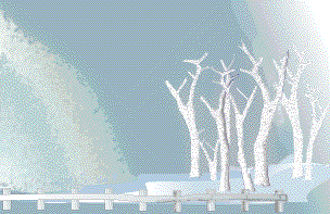
Between stops 2 and 3: crossing the Siletz River.An embayment in the delta of the Siletz River has many dead trees standing in the water at high tide. These have been drowned. This terraine subsided from a very large earthquake that happened around 1700. Scientists have been able to determine the time of the event from collaboration of Native folklore and Japanese records. Earthquakes have happened on the average every 400 years along the Oregon coast. Anytime now... |
 This illustration from my memory... |
Created by STANLEY R. SANDERS, 1999
e-mail: sanders@transport.com
|
|
|
|