
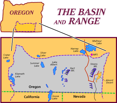
Basin and Range physiographic province covers an area of over 300,000 square miles and extends south from Oregon and Idaho, across Western U.S. and into Mexico. This vast region is marked by over a hundred mountain ranges spaced by intervening valley basins. Many theories are current on the possible forces which have caused this intriguing landscape. Several concepts center on the physical events that caused the North American continental crust to tear free from the adjoining land mass that is now Europe and N. Africa and "float" away creating the Atlantic Ocean.
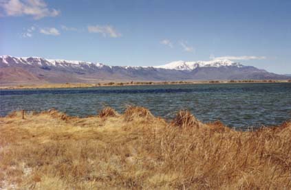
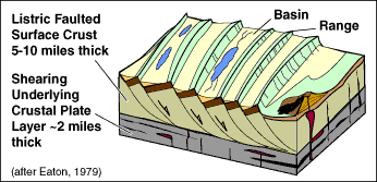
Tectonic forces of moving crusts of the Earth are thought to have stretched the materials of the Great Basin to more than double the original surface area. Faults formed where the stress overcame the tensile strength of the rock. Great blocks of the Earth's crust began to adjust to gravity and forces of upwelling magma that rose through these zones of fractures and fissures. The blocks of crust toppled and rose and fell like children's dominoes Differences in levels of these crustal blocks is thought to have reached over three miles in altitude before the Pliestosene glaciers ground the highest promontories to what we see today. In Oregon, the fault blocks that formed the Steen's Mountain have a difference of over a mile in altitude. By analysis of fossils found in the sediments of the lakes that formed in the early basins, the faulting and block formations is thought to have started in the Miocene, 16 to 8 m.y.a. During the Pliestocene the climate became much wetter and huge pluvial lakes formed in the basins while massive glaciers carved away the upper peaks of the mountains. These lakes lasted hundreds of thousands of years creating thick deposits of diatoms, and drying into alkali flats, playas. The lakes that remain in this province are the small vestiges of these previous bodies.
 One of the greatest volcanic events in the province was the eruption of a broad low shield volcano which produced a massive fluid basaltic flow across southeast Oregon. These covered 6,000 square miles and averaged 3,000 feet thick. These basalts make up the bulk of the Steens.
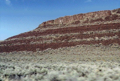 Wave-cut terraces can be seen in the slopes of the contemporay hillsides. And although todays dry climate and sparse vegetation gives the Northern Basin and Range the reputation of a desert, migrating waterfowl nest here in vast numbers and pass through these lake marsh basins in annual patterns.
