There are 3 different types of Columbia River basalts exposed here at Latourell Falls, those being the Grand Ronde basalts, the Frenchman Springs flow, and the Priest Rapids flow.
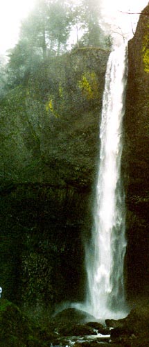 In this area at Latourell Falls you can very easily see an abundant amount of columnar jointing, which was formed because of the lava flows that have extensively covered this whole area. The flow ended up cooling, shinking, and then contracting, which it
can do so vertically very easily. When the flow is cooling it has a tendency to contract inwards, but in such a large expanse as from Idaho all the way to Latourell Falls it can not contract as a whole and so it ends up contracting inwardly in these nic
e hexagonal columns.
In this area at Latourell Falls you can very easily see an abundant amount of columnar jointing, which was formed because of the lava flows that have extensively covered this whole area. The flow ended up cooling, shinking, and then contracting, which it
can do so vertically very easily. When the flow is cooling it has a tendency to contract inwards, but in such a large expanse as from Idaho all the way to Latourell Falls it can not contract as a whole and so it ends up contracting inwardly in these nic
e hexagonal columns.
Another noticable feature in this area is there is a slight dip in the flow, going down on one side of the waterfall and then up the other side, resembling a valley. One of the theories for the formation of this area is that this is also an intercanyon fl
ow. Because of the nice valley shape that this area has, flows most likely filled this up, and you have columnar jointing in this area not at a vertically straight formation, but more at an angle where it has flowed in the erosion-forming v-shape carved
by the river.
What you can also see here is how a waterfall is being created. Where the waterfall is cutting back, in the cracks of the columnar jointing, water will collect, freeze, and expand resulting in the lower section craking and breaking off. This is refered
to as frost wedging.
At the top of the flow it is not columnar jointed, rather it is brick-brack jointed. The part of the flow that is brick-brack jointed doesn't have the nice, long cracks that the columnar jointed section does, meaning that there is significantly less fros
t wedging taking place and as a result the brick-brack jointed portion sustains much less erosion.
Another thing to point out is that it is always easier to erode between flows than in the middle of a flow. When a stream and a waterfall are in the area, it will erode inbetween flows causing them to "step-out." Most of the streams in this area such as
Multnomah Falls have steps to them which are present because the fall will erode the top of one flow unit and the bottom of another flow unit at a faster rate than the middle of the flow units, leaving sometimes numerous steps that the waterfall then des
ends down upon.
On the way back to the parking lot we stopped along the side of the trail to examine an exposed part of the flows. The first unit we looked at was a 25 million year-old formation, which tends to be more andisitic than basaltic, and is part of the origina
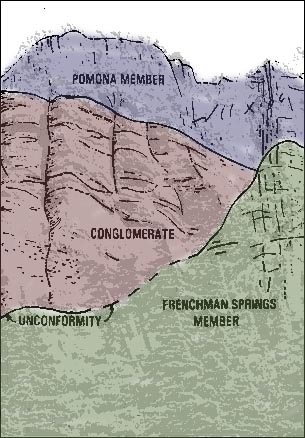
l building of the Western Cascades. You are able to see the difference in age between this flow and the Columbia River basalts. The Columbia River basalts were erupted 15 to 16 million years ago. There are 3 different types of Columbia River basalts ex
posed here at Latourell Falls, those being the Grand Ronde basalts, the Frenchman Springs flow, and the Priest Rapids flow. The Frenchman Springs flow and the Priest Rapids flow of the Wanapum Basalts are where the upper falls are, meaning that they are
significantly younger (about 14 million years old) as opposed to 15 or 16 million years old which the base of Latourell Falls is made up of.
|

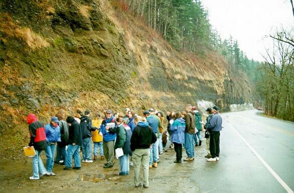
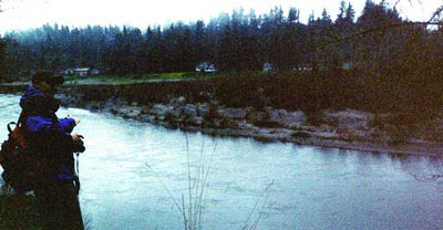 The first stop on our field trip was only a few miles from our meeting place at Lewis & Clark St. Park. We visited a cut bank along the Sandy River. On the west side of the river, opposite the cut bank, was a point bar containing coarser material at the
top (upstream), and the finer material of the point bar pointing downstream.
The first stop on our field trip was only a few miles from our meeting place at Lewis & Clark St. Park. We visited a cut bank along the Sandy River. On the west side of the river, opposite the cut bank, was a point bar containing coarser material at the
top (upstream), and the finer material of the point bar pointing downstream.
 The main rock type at this formation is conglomorate and sandstone. What this tells you about what has happened here is that this is a former cutbank of the Sandy river. The size of the particles tells you that these are channel deposits deposited by th
e river with varying velocities of flow. Of course the conglomerate would be a result of much higher flowrates as opposed to lower flowrates to deposit the sandstone. This area is known as the Troutdale formation. Rocks at this area tell you that this
used to be part of a river bed, a very big river bed, and it is not an incised meander. What we have here are river terraces.
The main rock type at this formation is conglomorate and sandstone. What this tells you about what has happened here is that this is a former cutbank of the Sandy river. The size of the particles tells you that these are channel deposits deposited by th
e river with varying velocities of flow. Of course the conglomerate would be a result of much higher flowrates as opposed to lower flowrates to deposit the sandstone. This area is known as the Troutdale formation. Rocks at this area tell you that this
used to be part of a river bed, a very big river bed, and it is not an incised meander. What we have here are river terraces.
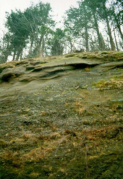
 Quartzite, basalt, and some grey andesitic type rocks which would have defintely come from Mt. Hood are present here. The rocks are very smooth and very rounded, and they have been abraded significantly, meaning that they have travelled over long distanc
es because quartz, being an extremely hard substance, is not going to be rounded easily. The quartzite found in this area did not come from the immediate area. Quartzite is not a local rock, and most likely came from Canada or from Montana in great flood
s.
Quartzite, basalt, and some grey andesitic type rocks which would have defintely come from Mt. Hood are present here. The rocks are very smooth and very rounded, and they have been abraded significantly, meaning that they have travelled over long distanc
es because quartz, being an extremely hard substance, is not going to be rounded easily. The quartzite found in this area did not come from the immediate area. Quartzite is not a local rock, and most likely came from Canada or from Montana in great flood
s.
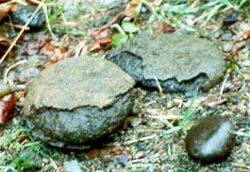 A nice weathering rind has developed on the rock in the picture to the left, and so that is one of things you are going to have in any kind of water environment. Where you've got water, you're going to have chemical weathering. On this rock you can see
both physical weathering of the rounding and the abrasion that a river has done, and you can see the chemical weathering of the material as well in the fact that there is a nice weather rind on this rock.
A nice weathering rind has developed on the rock in the picture to the left, and so that is one of things you are going to have in any kind of water environment. Where you've got water, you're going to have chemical weathering. On this rock you can see
both physical weathering of the rounding and the abrasion that a river has done, and you can see the chemical weathering of the material as well in the fact that there is a nice weather rind on this rock.
 From our vantage point at Multnomah Falls you could see a large display of pillow basalts. The land here is made up of pillow basalts, meaning the basalt was erupted into water.
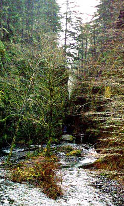 The Oneonta Gorge is a very unique habitat. Ecologically it is a very specialized area and contains some plants growing in it that grow nowhere else in the Columbia Gorge. In reference to the Davidian Cycle, the Oneonta Gorge would be in its youthful st
age while the Columbia Gorge would be in its mature or old age stage.
The Oneonta Gorge is a very unique habitat. Ecologically it is a very specialized area and contains some plants growing in it that grow nowhere else in the Columbia Gorge. In reference to the Davidian Cycle, the Oneonta Gorge would be in its youthful st
age while the Columbia Gorge would be in its mature or old age stage.
 River caused by an enormous mass wasting event that completely blocked up the river
allowing people to literally walk across the river on a natural "bridge". When European-American settlers heard this story, they interpreted the "bridge" as being similar to thier man-made wood and stone bridges that Europeans and European-Americans had
been able to build for many centuries now, and the story of a bridge over the Columbia River confused many white settlers to the area. These settlers ended up trying to discount any notion that "these savage types would be able to harmess the will or int
elligence to build something so out of place in thier culture." Little did they know that the Native tribes of Oregon had no need to control nature and build a bridge, they were content with adapting to the land instead of manipulating it.
River caused by an enormous mass wasting event that completely blocked up the river
allowing people to literally walk across the river on a natural "bridge". When European-American settlers heard this story, they interpreted the "bridge" as being similar to thier man-made wood and stone bridges that Europeans and European-Americans had
been able to build for many centuries now, and the story of a bridge over the Columbia River confused many white settlers to the area. These settlers ended up trying to discount any notion that "these savage types would be able to harmess the will or int
elligence to build something so out of place in thier culture." Little did they know that the Native tribes of Oregon had no need to control nature and build a bridge, they were content with adapting to the land instead of manipulating it.
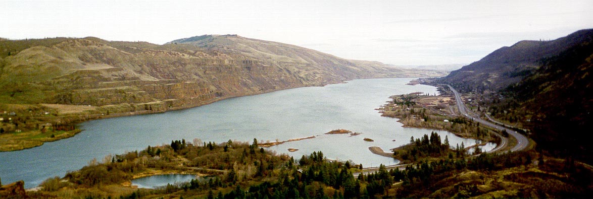
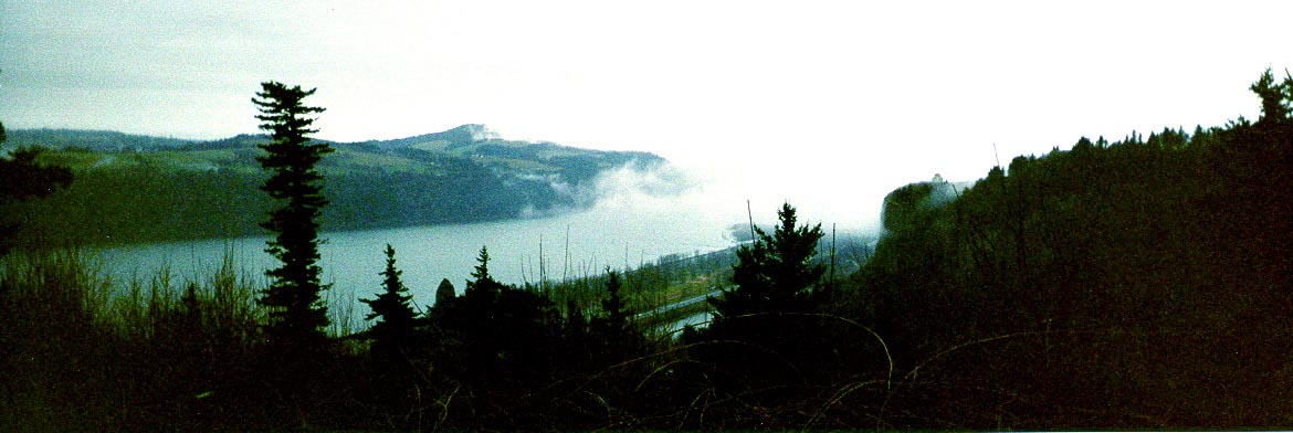
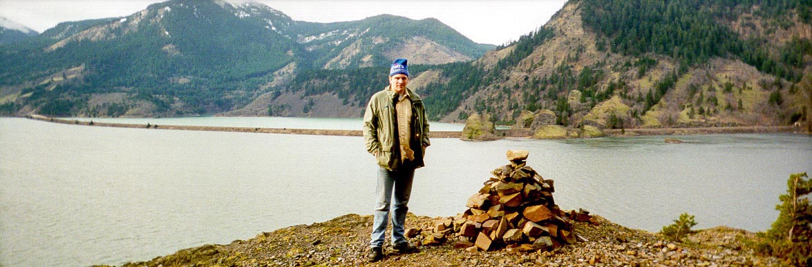
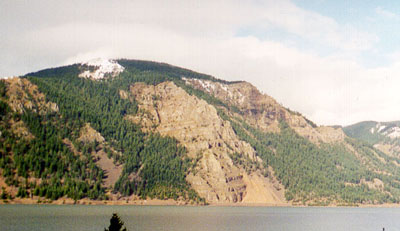 The rest area at Starvation Creek had been closed, so as we arrived we parked right alongside I-84. Shellrock Mt., located south of the Columbia River in Oregon, and Wind Mt., north of us in Washington, are both creeping towards the river ever-so-slightl
y, causing the river to narrow a bit in this area.
The rest area at Starvation Creek had been closed, so as we arrived we parked right alongside I-84. Shellrock Mt., located south of the Columbia River in Oregon, and Wind Mt., north of us in Washington, are both creeping towards the river ever-so-slightl
y, causing the river to narrow a bit in this area.
 blocked up the Salmon River is the easiest place for the river to cut through, and that it where the river cut through and now comes out, whereas it used to come and meet the Columbia in the entire valley there that is now filled with the flow.